http://forum.eeeuser.com/viewtopic.php?id=10724
Author: mr.snow
Crimespotting: the new way to make money on the Internet

City of Quartz, Fortress LA
http://www.lcc.gatech.edu/~broglio/1101/davis.html
Port 80.
- Point Google Earth kml file to Google App Engine.
- A random start airport from our list of 80 airports is selected.
- One or two destinations are selected from our list perhaps predicate on an actual commercial airline servicing that route.
- SID (Standard Instrument Departure) calculated from runway.
- Connects to waypoint database selecting nearby waypoints. Selects appropriate nearby inline point. Iterate until near first desination.
- Then STAR to runway.
Rinse and repeat.
The KML file needs to know that it should be updated regularly. It should periodically contact the App and get the next waypoint and crease object that describes the next section of the flight corridor.
An extension might be to run a massively parallel computation in the cloud attempting the travelling salesman problem on a subset of the set of 80.
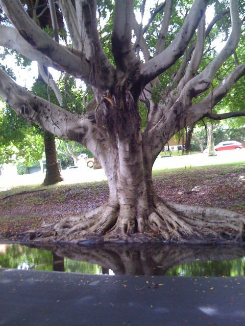
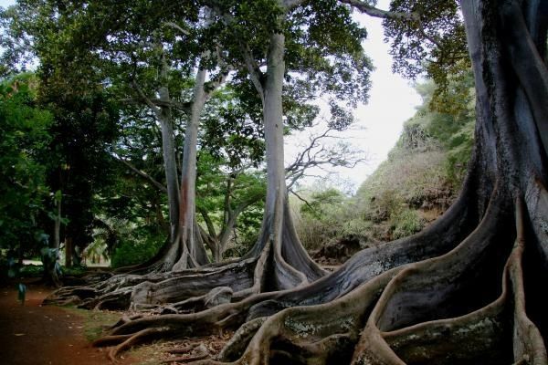
Bush Telegraph australias remarkable trees
http://www.abc.net.au/rn/bushtelegraph/
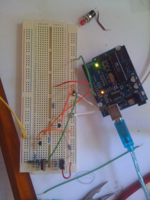
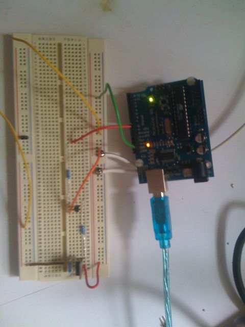
Testing the h bridge.
See links to read the tutorial I followed. I’ll update a parts list soon and post better images. This circuit is half an h bridge and implements power on and forward current only (no reverse).
I need to do sone evaluation to determine if the resistors are correct and if the transitors are handling the heat.
Dark Roasted Blend: Living, Growing Architecture
Day of the figs
http://www.darkroastedblend.com/2009/09/living-growing-architecture.html
The day of the figs.
An array of zigbee networked sensors collect salinity, hydrological, humidity and temperature data and relay it to the central system. The system is loaded with models describing historic Sydney brick and sandstone buildings. A series of scripts and programmes grows fig trees on the buildings using environmental data to activate growth cycles.


Sony patents reveal emotion recognition software // News
http://www.gamesindustry.biz/articles/sony-patents-reveal-emotion-recognition-software
Global media scares.
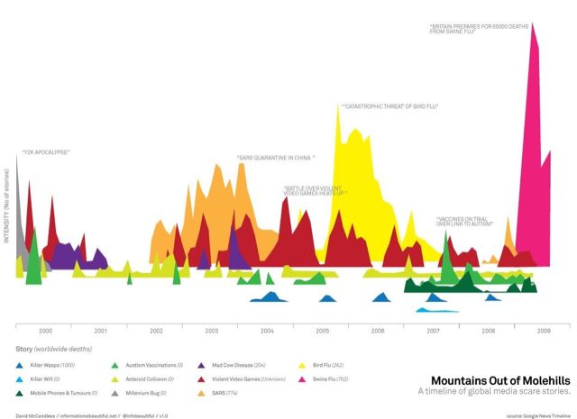
http://www.informationisbeautiful.net/visualizations/mountains-out-of-molehills/